
RTx/GPS System
Introducing the Rocket Telematics System
From Wikipedia:
Telematics as an interdisciplinary field encompasses telecommunications, vehicular technologies, road transportation, road safety, electrical engineering (sensors, instrumentation, wireless communications), and computer science (multimedia, Internet, etc.).
The RTx System goes way beyond the notion of a radio downlinked GPS stream... it provides operation in it's simplest form as a non-radio GPS logging device, to it's most complex operations that supports multiplexed GPS/RRC3 status that can marry up in many configurations to best suit your projects and your budget.
The RTx system utilizes the extremely capable uBlox 7 GPS chipset operating at a 10Hz refresh rate, while also utilizing its "high dynamics" mode of operation for quick coordinate re-acquisition once you coast back into the sonic region (<1000 fps).
The RTx system also supports multiple orientations of the uBlox 7 module and its specially detuned patch antenna (tuned for embedding). It can be mounted conventionally lying flat on the main board, or oriented skyward for the most optimal satellite constellation reception using our specially designed 3D-printed support brace.
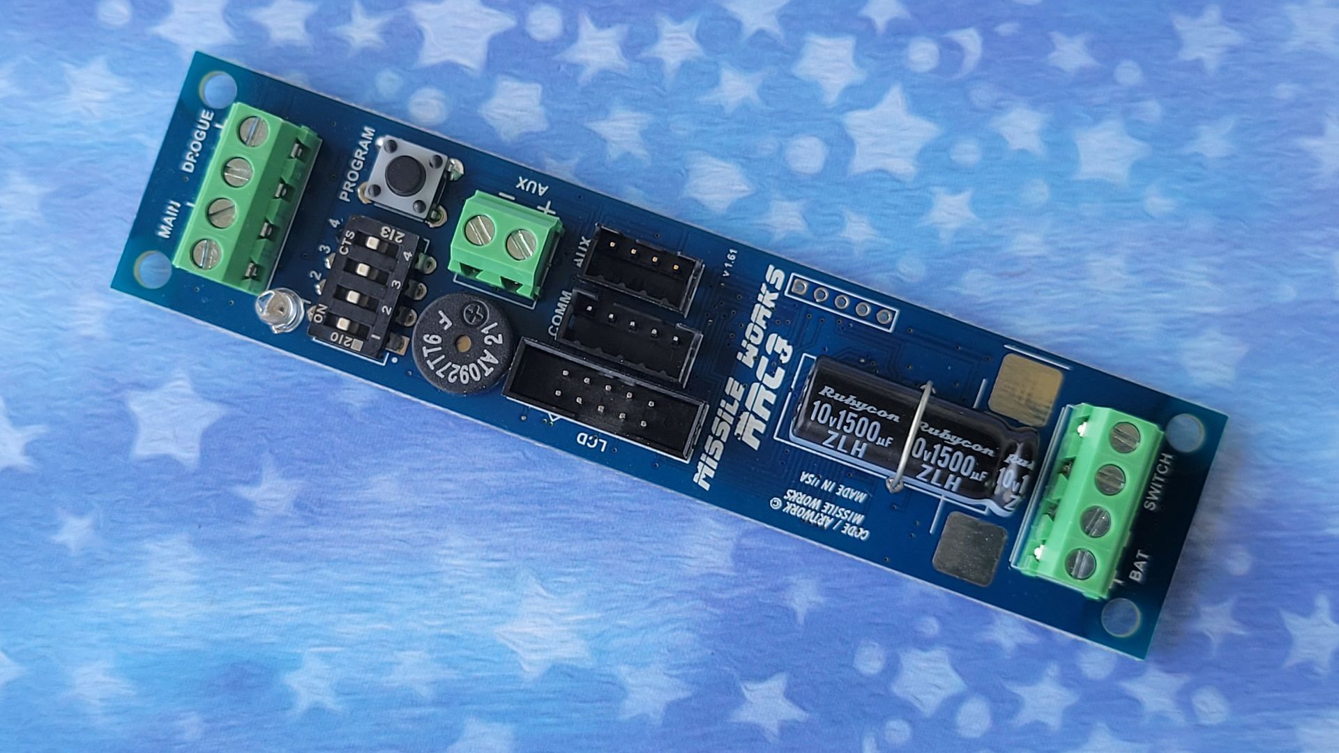
The RTx System is 100% plug and play ready with the RRC3 and all the existing m3 modules. Using the LCDT module, the RTx system displays (5) live LCD "stream screens" :
- Rocket Lat/Lon
- GPS Detail (sats, elevation, velocity, course and speed over ground)
- RRC3 Status (altitude, events, velocity, temp, mission clock, and voltage)
- NAV screen (distance/bearing to rocket with base bearing/ETA)
- Battery & Up Time (rocket and base unit)
The RTx board supports live data stream output via our HC-06 Bluetooth module and is ready to operate with Google PlayStore apps like "Rocket Locator" and "Bluetooth GPS". Alternatively you can stream data via the USB-IO or Bluetooth to PC apps like uCenter with live Google Map overlays, and run our mDACS PC app to retrieve GPS Epoch logs to overlay and export into Google Earth.
The base station RTx board also supports its own independent GPS module for a 100% autonomous real-time navigational solution, or use it in tandem with your smart phone, tablet, or handheld GPS system for navigation to the landing area. GPS coordinate data is provided in (4) unique formats so there's no fumbling when transposing data into a 3rd party app or your handheld GPS.
The RTx system uses the standard 250mW XBee 900 MHz ISM Radio system to provide booming, interference free downlink capabilities.
Specifications
Microcontroller 16MHz 16-bit MSP430 Series mCU
Onboard Flight memory 4Mbit SST Flash Memory
(stores 3 GPS flights @ 68 minutes each)
GPS Operational Ranges Altitude: 50,000 meters / 160,042 feet
Velocity: 500 meters sec / 1640 fps
Radio Operational Ranges 902 to 928 MHZ (selected channels)
Range up to 9 miles (with 2.1 dipole)
Operational Voltage 3.5 volts to 10 volts (1S Lipo recommended)
Operational Current @9V / ~70ma (quiescent) / ~190ma (peak)
Dimensions 28.5mm x 114.3mm (1.125" x 4.5")
Radio Network Addressing XBee Pro 900HP Preamble ID: 5
XBee Pro 900HP Network ID’s: 0 thru 7FFF
